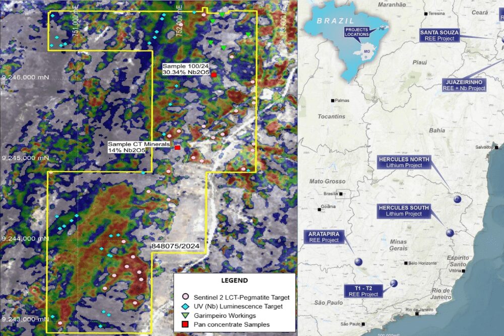


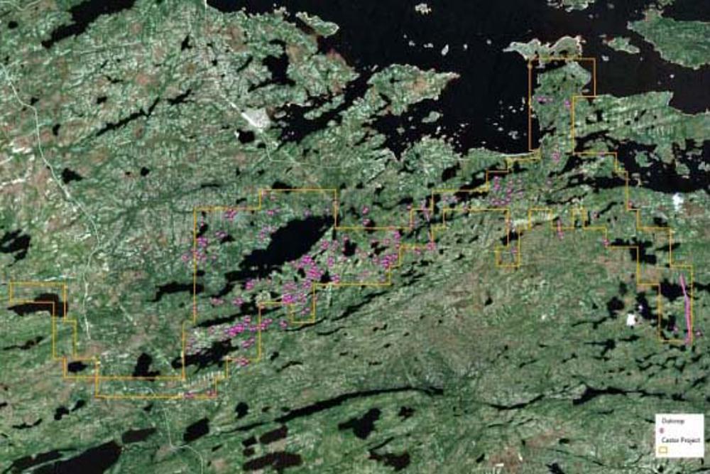
Summit Minerals Limited announced the results of its recent interpretation of Sentinel-2 Multispectral Imagery for the identification of outcropping potential lithium pegmatite within the Castor Project for the James Bay area in Quebec.
Some 228 potential pegmatite outcrops were located within the claim boundaries.
GeoCloud Analytics was employed to source, process and interpret the images, which resulted in the identification of potential outcrops for field reconnaissance, mapping and sampling in the early exploration phase.
Summit Exploration Manager Jonathan King said: “The work of GeoCloud expands upon earlier work completed by Dirt Exploration, resulting in several distinctive mineral occurrence clusters on the project’s western limb that potentially reflect pegmatite and lithium-bearing minerals. Several targets from the two work programs overlap within the project’s central hinge, providing confidence to the targets as each consultant’s approach was independent and, yet, derived the same interpreted target.”
Summit will soon conduct helicopter-supported property traverses to map and collect rock chips from the pegmatite occurrences and the interpreted Sentinel and SAR targets.
This work is expected to be completed by December 2023.